The Oxford Canal is a 78-mile narrowboat inland waterway in central southern England linking Coventry and Oxford via Banbury. It features 46 functional locks and maintains strict maximum vessel dimensions of 72 feet in length and 6 feet 10 inches in width.
- What is the ecological significance and wildlife habitat of the Oxford Canal?
- How did the construction and early history of the Oxford Canal develop?
- Which engineering features and locks define the Oxford Canal system?
- What caused the commercial decline and modern transition of the waterway?
- FAQs About Oxford Canal
- Can you live on a narrowboat permanently on the Oxford Canal?
- How long does it take to boat the entire length of the Oxford Canal?
- Is the Oxford Canal safe for open water swimming?
- What is the difference between the North and South sections of the Oxford Canal?
- Where can you connect to other canals from the Oxford Canal?
The industrial infrastructure connects the Coventry Canal at Hawkesbury Junction in Warwickshire to the River Thames at Isis Lock in Oxfordshire. The system serves as a foundational component of the English inland transport network. It traverses three distinct English counties consisting of Warwickshire, Northamptonshire, and Oxfordshire. The route retains a dual classification divided into the northern section and the southern section. The northern section runs from Hawkesbury Junction to Braunston, spanning a distance of 21.5 miles. The southern section continues from Napton through rural landscapes to central Oxford, covering approximately 53 miles.
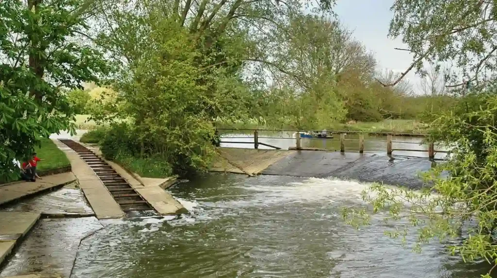
The structural engineering follows the specific parameters of a contour canal. The original design follows natural topography along the hillsides to eliminate the need for deep cuttings or high embankments. This preservation of land elevation creates an irregular path with frequent meanders. A prominent example includes the section between Priors Hardwick and Fenny Compton. The canal travels 5.5 miles to cover a geographic distance of only 2.2 miles as the crow flies. The maximum draft allowed for vessels navigating this channel is 4 feet. The maximum overhead headroom clearance is limited to 6 feet. The water supply relies heavily on the River Cherwell.
What is the ecological significance and wildlife habitat of the Oxford Canal?
The Oxford Canal serves as a critical green corridor that supports diverse populations of protected European wildlife and native plant species. The slow-moving aquatic environment provides essential nesting grounds and foraging territory for birds, mammals, and freshwater fish along its entire 78-mile length.
The unpolluted sections of the channel sustain delicate populations of the endangered European water vole, which nests along the undisturbed earth banks of the southern section. Apex predators like the Eurasian otter utilize the canal meanders to travel safely between isolated river catchments without encountering highway traffic. Dense patches of emergent vegetation, including common reed and yellow iris, filter agricultural runoff and stabilize the historic towpath structures against erosion. Avian species such as the common kingfisher and the grey heron rely on the shallow margins of the contour canal to hunt for small fish like roach, perch, and three-spined stickleback. Submerged aquatic plants like the arrowhead and various pondweeds provide critical spawning habitats for these native fish populations during the spring season.
What rules and management practices govern navigation on the Oxford Canal?
Navigation on the Oxford Canal is strictly regulated by the Canal & River Trust to balance heritage preservation with modern recreational use. All operating motorized vessels must possess a valid boat license, valid third-party insurance, and an active Boat Safety Scheme certification.
The maximum speed limit on the waterway is fixed at 4 miles per hour to prevent vessel wakes from damaging the historic earth banks and disrupting wildlife habitats. Operators must manually open and close the characteristic wooden lift bridges and single-gate locks while ensuring that water levels remain balanced across the summit reaches. Mooring is permitted along most standard towpaths for up to 14 days at a single location, though designated high-traffic zones in historic town centers enforce shorter 48-hour restrictions. Boaters must comply with strict environmental waste management protocols, utilizing specific sanitary disposal stations situated at major junctions like Braunston and Thrupp. The trust conducts regular seasonal dredging operations and masonry repairs to prevent silt accumulation from restricting the maximum 4-foot vessel draft.
How did the construction and early history of the Oxford Canal develop?
The Oxford Canal developed through an Act of Parliament passed in 1769 to transport Warwickshire coal to London. Celebrated engineer James Brindley supervised the initial construction until his death in 1772, when his assistant Samuel Simcock assumed control.
The infrastructure project faced severe financial constraints that extended the total construction timeline over a period of twenty years. Sir Roger Newdigate chaired the canal company and promoted the legislation in Parliament to secure commercial investments. The northern section reached the town of uk/local/banbury/">Banbury by the year 1778. The final southern section connecting to the River Thames officially opened during a formal ceremony on January 1, 1790. The completion established a direct commercial transport link between the industrial Midlands and the capital city of London.
The canal company implemented significant cost-cutting measures during construction to manage capital shortages. Engineers built single wooden lift bridges and rotating swing bridges instead of permanent brick structures. They designed single-gate narrow locks to reduce masonry expenses and conserve water volume. The canal immediately became one of the most profitable and heavily utilized commercial transit routes in Great Britain. Heavy barges moved thousands of tons of coal, stone, and agricultural products annually. The monopoly ended when the Grand Junction Canal opened in 1805. The competing route provided a faster, more direct line to London markets.
Which engineering features and locks define the Oxford Canal system?
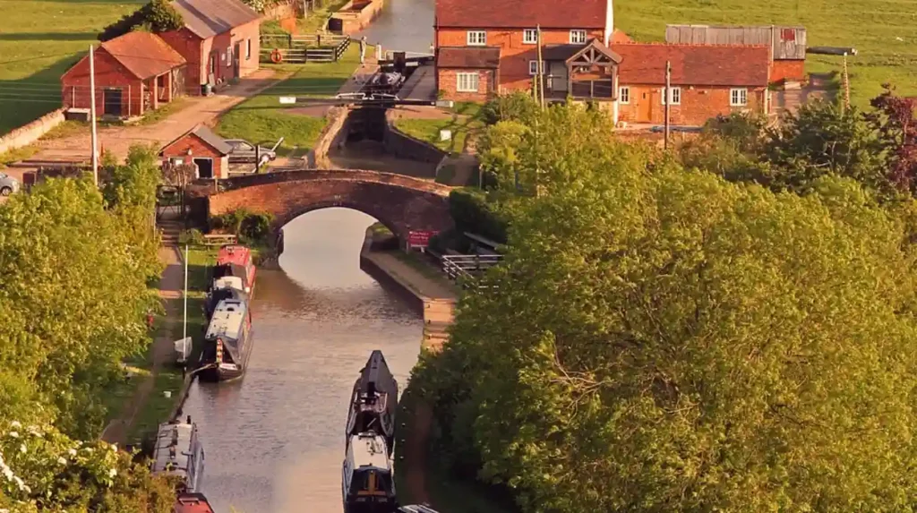
The engineering features of the Oxford Canal system include 46 distinct locks, three historic tunnels, and multiple lift bridges. The infrastructure includes specialized twin paired locks at Hillmorton and a major deep earthwork cutting at Fenny Compton.
Minnie Bannister
The locks regulate water levels to allow narrowboats to ascend and descend varying natural elevations along the valley. The Hillmorton Locks feature three pairs of parallel double locks built to double traffic capacity and minimize transit delays. The Napton flight comprises nine sequential narrow locks that lower boats down the Warwickshire plain. The Claydon Locks form a group of five structures that dictate the southern descent toward Oxford. The summit of the canal is bounded by Claydon Top Lock and the northern entrance gates.
The Newbold Tunnel represents a critical infrastructure modification completed in 1834 to modern standards. The tunnel measures 270 yards in length and features a wide bore with integrated towpaths on both sides. It replaced an earlier, smaller 1770s tunnel whose ruins remain visible in the nearby churchyard of Newbold-on-Avon. The Fenny Compton Tunnel underwent a complete structural conversion during the mid-nineteenth century. Engineers removed the tunnel roof to transform the underground passage into a wide, deep open cutting. The intersection at Hawkesbury Junction utilizes a specialized stop lock with a minimal 1-foot lift. This specific mechanism historically prevented water theft between competing private canal companies.
What caused the commercial decline and modern transition of the waterway?
The commercial decline of the Oxford Canal was caused by rapid railway expansion during the 1840s and changing industrial demands. The independent waterway survived through competitive toll restructuring until nationalization in 1948 transferred control to British Waterways.
Commercial cargo traffic on the rural southern section diminished steadily throughout the early twentieth century. Regular long-distance coal transport continued on the straightened northern section until the late 1960s. The southern channel faced complete abandonment and closure due to silt accumulation and decayed lock infrastructure. The Inland Waterways Association organized public campaigns to protect the historic channel from permanent destruction. Baron Nuffield purchased the main urban canal basin in central Oxford during 1937. He filled the terminal docks to construct Nuffield College.
The transition from an industrial highway to a public leisure resource accelerated during the 1970s. The Canal & River Trust currently manages the 78-mile asset as a registered environmental and heritage charity. The historic towpath now forms the 82-mile Oxford Canal Walk for public recreation. Private narrowboats, holiday rental fleets, and permanent residential moorings have replaced the traditional wooden working barges. The modern waterway supports regional tourism, protects biodiversity, and preserves eighteen-century civil engineering techniques.
FAQs About Oxford Canal
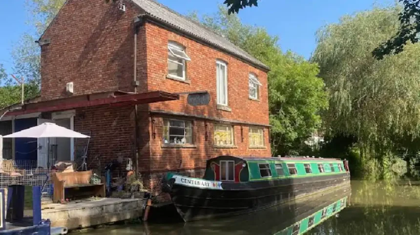
Can you live on a narrowboat permanently on the Oxford Canal?
Yes, individuals can live on a narrowboat permanently by obtaining a continuous cruiser license or renting a long-term residential mooring. Continuous cruisers must move their vessels to a new location every 14 days following Canal & River Trust guidelines. Residential moorings are available at designated locations, including Thrupp Wharf and Banbury.
How long does it take to boat the entire length of the Oxford Canal?
Boating the entire 78-mile length of the Oxford Canal takes approximately five to seven days of active travel. The journey requires navigating 46 locks and numerous lift bridges at an average speed limit of 4 miles per hour. The total travel time varies depending on seasonal boat traffic and lock congestion at the Napton flight.
Is the Oxford Canal safe for open water swimming?
The Oxford Canal is not recommended for open water swimming due to hidden underwater hazards, boat propeller currents, and water quality issues. Runoff from agricultural land and urban areas introduces pollutants into the slow-moving channel. Swimmers seeking managed outdoor waters should utilize dedicated local facilities, such as the historic Hinksey Outdoor Pool.
What is the difference between the North and South sections of the Oxford Canal?
The North Oxford Canal is straighter and wider because engineers shortened and re-engineered the route during the 1830s to improve commercial transit. The South Oxford Canal retains its original 1790 configuration, following the winding contours of the landscape. The northern section contains fewer locks, while the southern section features heavy lock flights and rural lift bridges.
Where can you connect to other canals from the Oxford Canal?
Boaters can connect to the wider UK network at three major junctions along the route. The northern terminus at Hawkesbury Junction links directly to the Coventry Canal. Braunston Junction and Napton Junction connect the waterway to the Grand Union Canal. The southern terminus at Isis Lock provides access to the River Thames via the Sheepwash Channel.