Key Points
- Official Drought Declaration: Much of the south of England, including Oxfordshire and the Thames Valley, was officially declared in drought from Wednesday, July 29, following a prolonged spell of hot and dry weather.
- Initial Restrictions: The Environment Agency initially rolled out navigation restrictions starting Saturday, July 25, stretching from St John’s Lock in Gloucestershire down to Osney Lock in Oxford.
- Extended Measures: From Monday, August 3, these strict navigation constraints were further expanded to cover additional river stretches, specifically from Goring Lock to Culham Lock and from Penton Hook Lock to Shepperton Lock.
- New Operating Limits: Passage through the impacted locks is now heavily capped, restricted to only one upstream and one downstream movement every 30 minutes.
- Overnight Closures: Mandatory overnight lock closures are now strictly enforced across the regulated zones daily from 6:00 PM until 9:30 AM.
- Core Objectives: The Environment Agency stressed that these emergency measures are essential to conserve shrinking water levels within the river system, protect public water supply abstractions, and manage navigation safety.
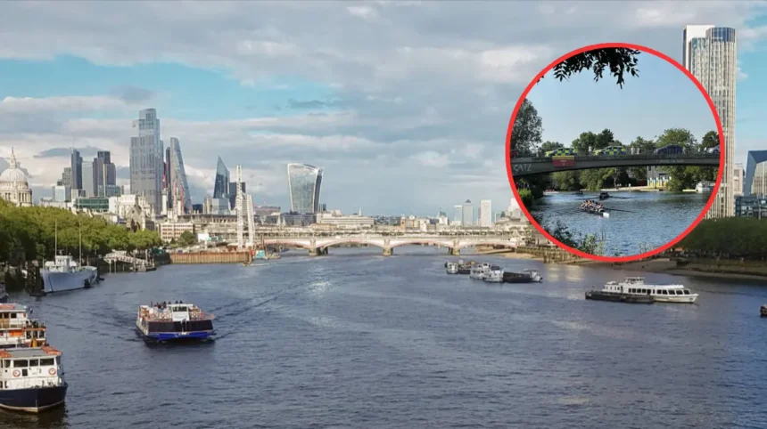
Oxford (Oxford Daily) August 4, 2026 – Navigation across vital stretches of the historic River Thames faces mounting disruption as authorities implement sweeping emergency constraints to combat a worsening regional drought. Following an official drought classification covering vast swathes of southern England, including Oxfordshire and the wider Thames Valley from Wednesday, July 29, the Environment Agency has widened its operational clampdown on lock pathways. The ongoing crisis, triggered by weeks of relentless high temperatures and severely depleted rainfall, has forced regulators to tightly schedule boat movements, execute strict overnight lock shutdowns, and warn river users that additional restrictions could follow if dry conditions persist.
Why are navigation restrictions being expanded on the River Thames?
The widening scale of the crisis became apparent as the Environment Agency confirmed that initial controls implemented in late July were no longer sufficient to counter the lack of moisture in the river basin. As reported by journalists at the Oxford Mail, the Environment Agency stated that the ongoing dry weather and soaring temperatures have placed unprecedented stress on available water resources while public demand for drinking water remains stubbornly high.
Detailing the necessity of the intervention, a spokesperson for the Environment Agency stated that:
“We need to introduce these measures to conserve water within the river system, protect navigation levels and support water abstraction for public water supply.”
The agency further noted that every traditional lock operation transfers significant volumes of precious water downstream. Without immediate regulatory intervention, water levels risk plunging to points that would critically jeopardize both recreational navigation and the region’s raw drinking water reserves.
Which areas and lock systems are affected by the new rules?
The restrictions began incrementally before expanding across major sections of the waterway. Initially, as covered by the Oxford Mail, the Environment Agency introduced navigation controls starting from Saturday, July 25, spanning from St John’s Lock in Gloucestershire down to Osney Lock in Oxford.
However, as dry conditions deepened and the south of England slipped into an official drought status on Wednesday, July 29, the scope of the emergency response widened. As reported by the Oxford Mail, those strict regulatory boundaries were extended from Monday, August 3, to encompass additional key sections of the river, namely the stretches running from Goring Lock to Culham Lock, as well as the water network from Penton Hook Lock to Shepperton Lock.
Explore More Local Oxford News
Historic Cottage Restoration Plan Approved in Oxfordshire 2026
Magistrates Court Closure Extended Until November in Oxford 2026
What specific operating rules apply to boaters now?
For river users navigating the affected stretches, standard cruising procedures have been entirely upended. Passage through all regulated locks is now strictly capped at a maximum of one upstream movement and one downstream movement every 30 minutes.
In addition to the half-hourly transit caps, mandatory overnight lock closures are in full effect. Every evening from 6:00 PM until 9:30 AM the following morning, locks within the designated zones are closed off to prevent unmonitored water loss.
Addressing how river users can manage these sudden downtime windows, the Oxford Mail previously highlighted advice from the Environment Agency noting that boaters are permitted to utilize lock lay-bys for overnight mooring free of charge. Mariners have been strongly urged to plan their daily voyages meticulously to ensure they can secure safe mooring spots before the strict 6:00 PM evening shutdown takes effect.
Could more locks face closures if the dry weather continues?
With meteorologists indicating little immediate relief or significant rainfall on the horizon, authorities have refused to rule out further emergency actions. While current limitations remain concentrated around specific reaches, monitoring teams are evaluating daily data across the entire Thames basin.
Outlining the future outlook, the Environment Agency stated:
“While restrictions are currently either ongoing or being introduced at the above lock sites, we will continue to monitor conditions across the Thames. If the current period of drought and low river flow continues, it may become necessary to introduce similar water conservation measures in other parts of the river, particularly in reaches that support public water supply abstraction.”
The regulatory body has also confirmed that any upcoming limitations will depend heavily on localized operational demands and real-time environmental shifts. Officials have pledged to keep staff, commercial stakeholders, and recreational river users promptly updated as conditions evolve across the network.