uk/local/abingdon/">Abingdon‑on‑Thames lies on the River Thames in Oxfordshire, offering a compact yet diverse network of riverside paths, historic town‑centre walks, and nearby viewpoints that are easy for day‑trippers to navigate. This guide explains the main routes, key attractions, how to combine them into routes of 2–5 km, and how the area fits into the wider Thames‑walk landscape.
- What are the main riverside walks in Abingdon‑on‑Thames?
- How do the Abingdon walks connect to the wider Thames Path?
- What are the key Thames‑side attractions near Abingdon?
- How long are typical riverside walks from Abingdon?
- What are the best viewpoints along the Abingdon stretch of the Thames?
- What facilities and amenities are available along the riverside?
- How do the Abingdon riverside walks suit different visitor types?
- What are the main practical considerations for walking these routes?
- How do the Abingdon walks compare with other Thames‑side routes?
- What is the future relevance of Abingdon’s riverside as a leisure destination?
What are the main riverside walks in Abingdon‑on‑Thames?
The core riverside walks in Abingdon cluster around the old river channel, the modern A4155 corridor, and the towpath linking the town to the wider Thames Path. They form a continuous but segmented loop that can be walked in short sections, typically between 1.5 km and 5 km per leg.
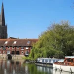
Three main segments define the riverside experience: the historic riverfront from Abingdon Lock to the County Hall area, the towpath heading downstream towards Culham and Cuxham, and the riverside parkland on the northern and western edges of the town. Each section offers a mix of river views, open green space, and glimpses of Abingdon’s 18th‑ and 19th‑century riverside architecture.
For visitors starting from the centre, a typical 2–3 km loop runs from the Market Square down to the lock, then follows the towpath toward Culham, returning either along the same path or via the riverside park. Longer walkers can extend this into a 5–7 km journey by continuing along the Thames Path toward Benson or upstream toward Radley, all of which are waymarked National Trail routes.
How do the Abingdon walks connect to the wider Thames Path?
The Abingdon‑area walks are part of the National Trail‑designated Thames Path, which runs roughly 184 miles from the river’s source in Gloucestershire to the Thames Barrier in London. Abingdon sits on the lower‑middle section of this route, roughly 20–25 miles upstream of Henley‑on‑Thames and about 40 miles downstream of Lechlade.
The formal Thames Path enters Abingdon from the west via Radley and Culham, following the riverbank and then the towpath through the town. East of Abingdon, the path continues via Culham Lock and the Cuxham area, eventually joining the main Oxford–Wallingford–Henley corridor that is heavily used by walkers and cyclists.
For day‑trippers, this means short out‑and‑back walks (for example, Abingdon Lock to Culham, 3–4 km), or linking Abingdon to nearby towns such as Culham, Radley, or Sutton Courtenay on single‑stage routes. As you explore the modern riverside, you are crossing land with a deep heritage.
What are the key Thames‑side attractions near Abingdon?
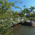
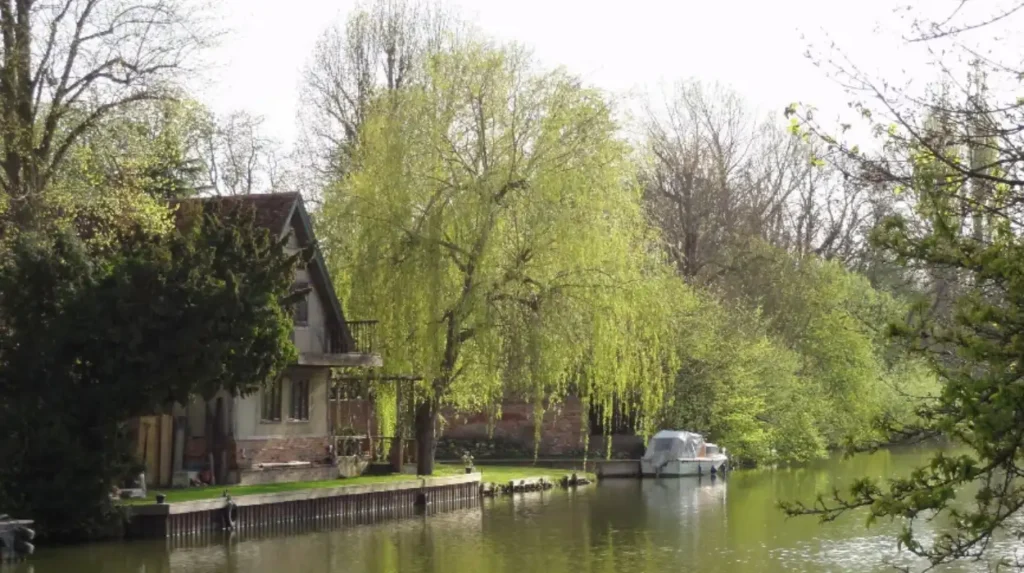
The most prominent riverside attractions in and around Abingdon include Abingdon Lock, the historic town‑centre riverfront, and the green spaces that frame the Thames as it passes through the town. These points are frequently used as start‑points for day‑walks and short cycling routes.
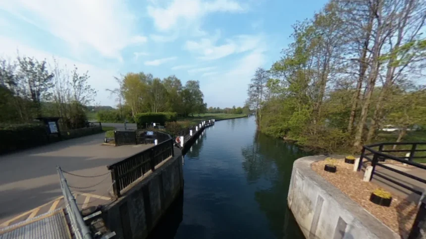
Abingdon Lock and the associated weir are a key focal point, with an adjacent footbridge and viewing areas that allow visitors to watch river traffic and observe the weir’s operation. The lock dates from the 18th century and forms part of the Thames’ navigation system, which now supports leisure boating as well as ecological management of water levels.
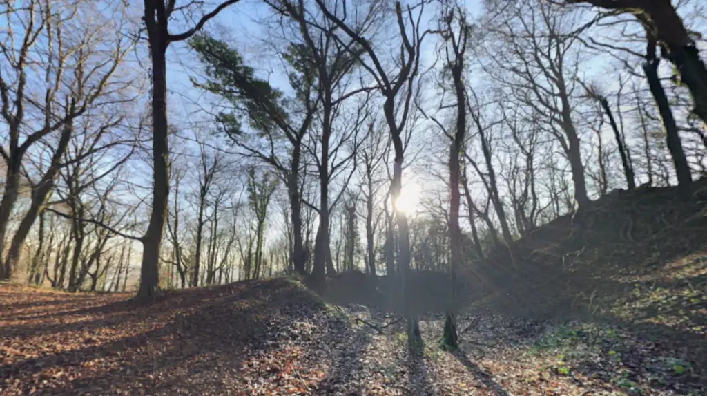
Further along the river, the local riverside park and the open meadows near Culham provide picnic‑friendly spaces and viewpoints across the river. These areas are often combined with visits to nearby attractions such as the Wittenham Clumps, which lie a short distance north of the Thames and offer panoramic views over the river valley and Oxfordshire countryside.
How long are typical riverside walks from Abingdon?
Most riverside routes starting in Abingdon‑on‑Thames fall into three practical ranges: short urban loops (1.5–3 km), half‑day walks (3–7 km), and full‑day or multi‑section journeys (7–15 km). These distances align with the Thames Path’s way‑marked stages around Oxfordshire towns.
A short loop of 1.5–3 km can be done by walking from the town centre to Abingdon Lock, then following the towpath part‑way towards Culham before turning back. This stretch is especially suitable for families and leisure walkers, with flat, surfaced paths and frequent access points where the route crosses roads.
Half‑day routes of 5–7 km often extend from Abingdon to Culham or Radley, using the continuous riverside towpath and then returning along the same route or via quiet roads. Full‑day itineraries of 7–15 km may link Abingdon to Sutton Courtenay or the wider Oxford–Berkshire corridor, sometimes combined with a train back from nearby stations such as Culham or Dorchester‑on‑Thames.
What are the best viewpoints along the Abingdon stretch of the Thames?
The best viewpoints near Abingdon break broadly into three types: close‑up riverside spots, higher‑level viewpoints across the river, and elevated positions slightly away from the water. Each offers a different perspective on the river’s bend through the town and the surrounding Oxfordshire landscape.
Immediately in Abingdon, the most accessible viewpoints are along the town‑side riverfront, where benches and low stone walls frame views of moored boats, the lock, and the weir. Slightly further along the towpath, the area near Culham Lock and the surrounding meadows provides open sightlines across the river, particularly in the morning when the light is low and reflections are strong.
For a more elevated panorama, the Wittenham Clumps—two wooded hills about 4–5 km north of the river—offer one of the best vantage points over the Thames valley around Abingdon. Paths up to the clumps from the village or nearby roads create a 3–5 km climb that delivers expansive views west towards Oxford and east along the river corridor.
What facilities and amenities are available along the riverside?
Basic amenities are concentrated in Abingdon town centre and at key access points, with more limited facilities directly on the riverside path. Visitors should plan water and snacks in advance if walking longer sections beyond the immediate town.
Cafés, pubs, and toilets are most reliably found in the Market Square and the nearby streets of Abingdon, within a 5–10 minute walk of the riverfront. Several riverside‑facing pubs and restaurants near the lock and the old town bridge offer seating where visitors can rest while still enjoying river views.
Public toilets and parking are available at designated town‑centre car parks and some riverside‑adjacent sites, but the towpath itself has few formal facilities beyond occasional benches and small picnic areas. For longer walks, walkers commonly use the train stations at Abingdon and Culham to access the route, then pick up refreshments in the town before heading out.
How do the Abingdon riverside walks suit different visitor types?
Abingdon’s riverside network is particularly well suited to tourists, leisure walkers, and some domestic business travellers, while also offering moments of quiet for residents and digital nomads working from nearby cafés. The terrain is predominantly flat or gently undulating, with surfaced paths and short road‑crossings that make it accessible for most abilities.
Leisure tourists and short‑stay visitors can comfortably complete a 2–3 km loop in 1–2 hours, combining a riverside walk with time in the town centre to visit the County Hall, St Nicholas Church, and Abbey Close. Day‑trippers from Oxford or Reading often use the train or bus to reach Abingdon, then walk along the Thames for 1–3 hours before returning by public transport.
For digital nomads and remote workers, Abingdon’s mix of cafés, pubs, and public spaces creates a “walk‑and‑work” environment where short riverside strolls can be combined with working from a nearby venue. Residents and local families use the riverside park and the lock area for informal exercise, dog walking, and after‑school walks, especially in the early evening.
What are the main practical considerations for walking these routes?
Walking the Abingdon riverside routes requires attention to a few key practical factors: route waymarking, surface conditions, weather exposure, and transport links. Planning around these helps visitors avoid long‑distance detours and unexpected climbs.
The Thames Path through Abingdon is waymarked with National Trail signage, but some sections merge with local‑authority‑maintained paths that may have less frequent markers. Using a simple online or offline map app is recommended, especially for half‑day or full‑day walks that extend beyond the immediate town towards Culham or Radley.
Surfaces vary from paved paths near the town centre to compacted gravel or well‑maintained grassy towpaths further out. In wet weather, these can become muddy or slippery, so water‑resistant footwear is advisable on longer outings. Walkers should also carry sun protection in summer, as much of the towpath is exposed and lacks shade.
How do the Abingdon walks compare with other Thames‑side routes?
Abingdon’s riverside offerings sit between the more urban experience of Oxford and the rural, wooded stretches of the Thames near Henley and Wallingford. It combines town‑centred architecture, working river infrastructure, and open riverside parkland in a compact area.
Oxford’s riverside walks are more densely built‑up, with colleges lining the river and frequent access points but fewer long stretches of uninterrupted towpath. In contrast, routes downstream towards Henley feature longer woodland‑bordered towpaths and more boating‑related infrastructure, such as moorings and regatta landscapes.
Abingdon’s advantage for many visitors is its compact scale: the core riverside loop can be completed in a short time, while still connecting to the wider Thames Path for longer journeys. For those combining a train‑based day out with a riverside walk, Abingdon offers a middle‑ground experience that is less crowded than Oxford but more developed than the deeply rural stretches of the river.
What is the future relevance of Abingdon’s riverside as a leisure destination?
Abingdon’s riverside is likely to grow in importance as leisure travel shifts towards accessible, low‑impact outdoor activities and short‑distance “micro‑adventures” from cities such as Oxford and Reading. Local authorities and regional tourism bodies already promote the Thames Path and nearby viewpoints as part of a broader “green corridor” strategy.
Ongoing investment in the Thames Path, including surface improvements, signage upgrades, and better links to public transport, is expected to make the Abingdon section more attractive to walkers, cyclists, and nature‑oriented visitors. At the same time, urban‑riverside regeneration and environmental‑management projects on the Thames will influence how the riverfront is used, balancing recreation, ecology, and flood‑resilience priorities.
For tourists and residents alike, this means that Abingdon’s riverside walks are positioned to remain a stable, evergreen destination for scenic leisure and outdoor exploration, rather than a purely seasonal attraction. Over the next decade, the combination of national‑trail status, nearby transport links, and proximity to Oxford ensures that the Abingdon riverside will continue to feature in regional‑scale walking and sightseeing itineraries.