Key Points
- Pedestrians and cyclists can use the River Thames towpath south of Donnington Bridge near the Isis Farmhouse Pub again after a four-month emergency closure.
- Engineers shut the route at the end of July 2026 to fix the failing river wall.
- Oxfordshire County Council reopened the path on November 12, 2026, pushing past the initial September 28 target listed on early closure notices.
- Workers brought the project forward from 2027 because inspections found widening cracks and rapid deterioration threatening public safety.
- Oxfordshire County Council partnered with principal highways contractor M Group, bridge specialists Greenford Ltd, the Environment Agency, and Oxford City Council on the repairs.
- Crews used an alternative piling method that cut 11.6 tonnes of embodied carbon and routed walkers and cyclists through Iffley Meadows during construction.
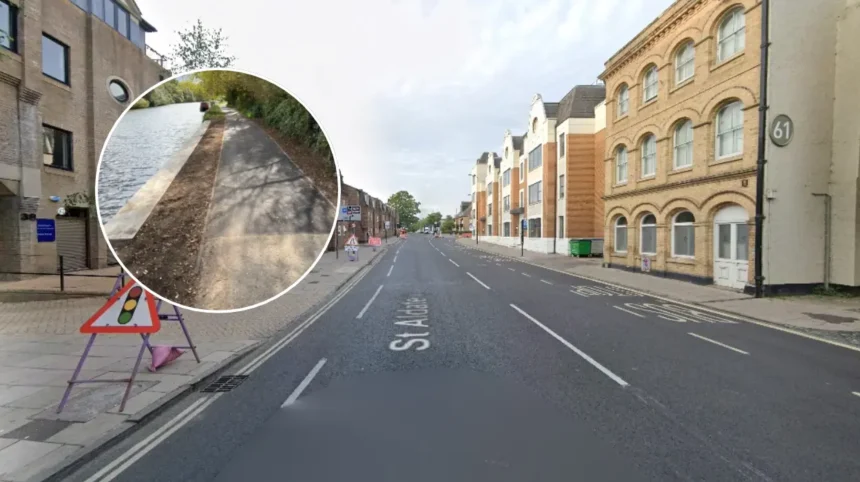
Oxford (Oxford Daily) November 12, 2026 – A popular section of the River Thames towpath in Oxford has officially reopened to pedestrians and cyclists following a four-month emergency closure to complete critical river wall repairs.
- Key Points
- Why was the Thames towpath in Oxford closed for four months?
- How were the emergency river wall repairs carried out?
- Which organisations collaborated on the Thames Path restoration?
- What is the background of riverbank erosion along Oxford’s Thames Path?
- What is the prediction for Oxford commuters, walkers, and river users?
The affected stretch of the Thames Path, positioned immediately south of Donnington Bridge and near the Isis Farmhouse Pub, had remained shut since the end of July after structural inspections revealed rapid deterioration.
Why was the Thames towpath in Oxford closed for four months?
As reported by the Oxford Times, the riverside footpath was shut at the end of July 2026 after routine monitoring showed the supporting river wall was failing faster than engineers had projected.
While signage installed along the temporary closure order initially listed an anticipated completion date of September 28, engineering requirements extended the closure into November. Oxfordshire County Council formally announced on November 12 that the barriers had been removed and public access restored.
As reported by the Oxford Times, Oxfordshire County Council’s cabinet member for highways construction and repairs, Councillor Liz Leffman, stated: “The successful completion of the emergency repairs safeguards this section of the towpath and reduces the risk of an unplanned closure of an important walking connection into Oxford.”
Councillor Liz Leffman further noted: “This is a well-used route, so it was vital that disruption was kept to a minimum while these essential works were carried out.”
How were the emergency river wall repairs carried out?
According to an official release from Oxfordshire County Council, the repair scheme had originally been pencilled into the authority’s maintenance programme for 2027. However, inspections identified widening cracks along the structure that presented an elevated safety hazard to members of the public using the route.
Oxfordshire County Council commissioned its principal highways contractor, M Group, to execute the accelerated reinforcement works. During the engineering phase, M Group implemented an alternative piling solution that reduced the project’s environmental footprint by saving 11.6 tonnes of embodied carbon.
To maintain connectivity while heavy machinery operated beside the watercourse, the council’s public rights of way team established a managed diversion through Iffley Meadows. The authority stated that the diversion and construction methods were specifically coordinated to protect the surrounding sensitive riverside ecosystem.
Which organisations collaborated on the Thames Path restoration?
As detailed by Oxfordshire County Council, delivering the emergency intervention required multi-agency coordination across local government and specialist engineering firms.
The council’s public rights of way officers worked alongside bridge specialists Greenford Ltd, the Environment Agency, and Oxford City Council to secure permits, manage flood-risk protocols, and oversee structural reinforcement along the bank.
Earlier coverage by Local Democracy Reporting Service journalist Isabella Harris, published by BBC News and the Oxford Mail in August 2026, highlighted that the Thames Path National Trail had warned walkers that a section of the riverbank had fallen into the Thames, necessitating urgent stabilisation.
What is the background of riverbank erosion along Oxford’s Thames Path?
The section of the Thames Path running through south Oxford has experienced recurring structural pressures caused by seasonal river surges, high footfall, and ageing bank retaining walls.
In June 2025, as reported by Chief Reporter Matt Simpson of the Oxford Mail, Oxfordshire County Council announced separate essential repair works along an eroding stretch of riverbank off Abingdon Road between Folly Bridge and Donnington Bridge, alongside preliminary maintenance near the Isis Farmhouse.
Furthermore, extreme weather events such as Storm Bert in November 2024 previously forced Oxford City Council to close six major footpaths across the city—including the stretches from Folly Bridge to Donnington Bridge and Donnington Bridge to the Eastern Bypass—due to severe flooding and bank saturation.
These cumulative hydrological stresses accelerated the structural degradation of the retaining wall south of Donnington Bridge, prompting engineers to bring forward the 2027 capital works to July 2026.
What is the prediction for Oxford commuters, walkers, and river users?
For daily commuters, recreational walkers, runners, and cyclists travelling between Iffley, Rose Hill, and central Oxford, the reopening eliminates the detour through Iffley Meadows and restores a direct, traffic-free active travel corridor into the city.
Local businesses situated directly along the route, particularly the Isis Farmhouse Pub and nearby boathouses south of Donnington Bridge, are expected to regain consistent passing footfall from Thames Path National Trail hikers and local residents ahead of the winter season.
With the reinforced piling now installed, Oxfordshire County Council expects the upgraded river wall to withstand high winter river flows without requiring the major structural closure previously scheduled for 2027, thereby providing long-term route reliability for both local active-travel users and long-distance trail walkers.