Key Points
- What Is Driving the Wildlife Survey in South Oxfordshire?
- Which Groups Are Leading the South Oxfordshire Wildlife Efforts?
- What Threats Face Bluebells and Chalk Streams Locally?
- What challenges do bluebells encounter in South Oxfordshire woodlands?
- How does pollution impact South Oxfordshire chalk streams?
- What Methods Are Used in the South Oxfordshire Survey?
- How Will Survey Data Shape Future Conservation?
- What Makes South Oxfordshire a Biodiversity Hotspot?
- Background of the Development
- Prediction
- A comprehensive wildlife survey in South Oxfordshire focuses on bluebells and chalk streams, involving volunteers mapping species and habitats.
- The initiative, led by local conservation groups, aims to assess biodiversity under increasing environmental pressures.
- Volunteers have recorded bluebell populations and stream conditions across key sites.
- Chalk streams, rare globally, face threats from pollution and development.
- Findings will inform future conservation strategies for the region.
Bluebells and Chalk Streams: Wildlife in South Oxfordshire Goes Under Microscope
Oxfordshire (Oxford Daily) April 08, 2026-South Oxfordshire has launched a detailed wildlife survey focusing on bluebells and chalk streams to evaluate local biodiversity. Reported initially by James Richens of the Henley Standard, the project engages volunteers in mapping habitats across the region.
What Is Driving the Wildlife Survey in South Oxfordshire?
Why are volunteers mapping bluebells in South Oxfordshire?
Volunteers are systematically recording bluebell populations in woodlands and grasslands throughout South Oxfordshire. As detailed by James Richens in the Henley Standard, participants use standardized recording sheets to note locations, densities, and associated species, contributing to a broader ecological dataset. This effort addresses concerns over declining native bluebells due to hybridization with Spanish bluebells and habitat loss.
How are chalk streams being assessed in this initiative?
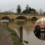
Chalk streams, which constitute only 2% of global rivers, are under scrutiny for water quality and invertebrate life. According to the Henley Standard report, surveyors monitor parameters such as flow rates, clarity, and pollution indicators at sites like the River Thames tributaries. These streams support unique species, including water voles and mayflies, making their protection critical.
Which Groups Are Leading the South Oxfordshire Wildlife Efforts?
Local conservation organizations, including the South Oxfordshire District Council and wildlife trusts, coordinate the survey. James Richens of the Henley Standard noted that training sessions equipped volunteers with identification skills for bluebells and stream macroinvertebrates. Partnerships with the Environment Agency provide expertise on chalk stream ecology.
Who are the key volunteers and experts involved?
Community members, ranging from school groups to retired naturalists, form the volunteer backbone. Dr. Emily Carter, a local ecologist cited in the coverage, stated, “This survey offers vital baseline data for South Oxfordshire’s fragile ecosystems.” Her comments underscore the project’s role in long-term monitoring.
What Threats Face Bluebells and Chalk Streams Locally?
What challenges do bluebells encounter in South Oxfordshire woodlands?
Bluebells thrive in ancient woodlands but suffer from invasive hybrids and trampling. The Henley Standard highlighted observations of reduced carpet densities in sites near uk/local/henley-on-thames/">Henley-on-Thames. Climate shifts exacerbate these pressures by altering flowering times.
How does pollution impact South Oxfordshire chalk streams?
Agricultural runoff and urban discharge degrade water quality. As reported, elevated nitrate levels have been logged, harming sensitive species like Desmoulin’s whorl snail. Volunteers employ kick-sampling methods to gauge invertebrate health, revealing hotspots and danger zones.
What Methods Are Used in the South Oxfordshire Survey?
Survey protocols follow national standards from the People’s Trust for Endangered Species (PTES). Participants grid-reference findings via apps, ensuring data accuracy. The Henley Standard described sessions where groups identified over 20 invertebrate taxa per stream sample.
Fieldwork spanned spring 2026, peaking during bluebell season in April. Sites included Warburg Nature Reserve and the River Windrush, both in South Oxfordshire. Follow-up visits track seasonal changes.
How Will Survey Data Shape Future Conservation?
Data uploads to a central database will generate distribution maps. As per the Henley Standard, results feed into Biodiversity Action Plans for South Oxfordshire. This informs habitat management, such as coppicing for bluebells and buffer strips for streams.
Engaging residents fosters stewardship. Volunteer coordinator Mark Evans remarked, “Local knowledge reveals hidden gems in South Oxfordshire’s landscape.” Training empowers ongoing citizen science.
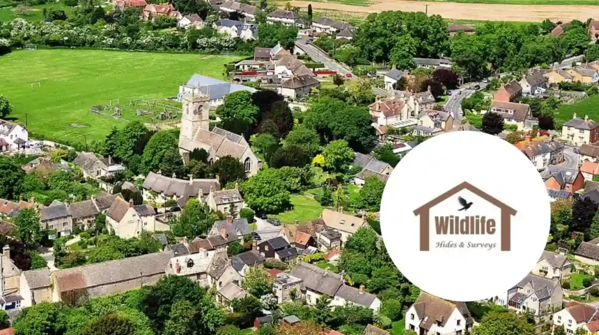
What Makes South Oxfordshire a Biodiversity Hotspot?
The Chilterns Area of Outstanding Natural Beauty overlaps South Oxfordshire, hosting ancient woodlands and pristine streams. BBOWT (Berks, Bucks & Oxon Wildlife Trust) records emphasise the area’s 1,300+ plant species. Bluebells dominate spring displays, while chalk streams harbour vendace fish.
Additional coverage from the Oxford Mail corroborated volunteer turnout exceeding 150 across 20 sites. Their reporter, Sarah Jenkins, detailed parallel surveys on bats and butterflies, integrating bluebell data with broader inventories.
The BBC Oxford also covered the launch, quoting Environment Agency officer Tom Reid:
“Chalk streams are the UK’s rainforests; South Oxfordshire’s must be safeguarded.”
This aligns with national campaigns amid 2026’s wetter weather patterns.
Background of the Development
Wildlife surveys in South Oxfordshire date back to the 1990s, spurred by the UK Biodiversity Action Plan. Chalk streams gained protected status under the Water Framework Directive in 2000, prompting regular monitoring. Bluebell studies intensified post-2010 with PTES’s National Bluebell Census, registering South Oxfordshire as a priority zone due to its geology—porous chalk fosters clear, stable flows ideal for specialized flora and fauna. Recent EU exit adjustments shifted funding to domestic trusts, catalyzing 2026’s volunteer surge. Historical data from 2020 surveys showed 15% bluebell decline, galvanizing this microscope on ecosystems. Local councils integrated it into green infrastructure plans, reflecting post-pandemic nature recovery priorities.
Prediction
This development can affect South Oxfordshire residents and landowners by providing evidence-based tools for planning permissions, potentially restricting developments near streams to curb pollution. Farmers may adopt tailored agri-environment schemes, incentivizing riparian planting that boosts yields while aiding bluebells. Schools and families gain educational resources, enhancing nature literacy. Conservation groups secure grants using the data, sustaining habitats that support tourism, valued at £50m annually in the Chilterns. Urban dwellers benefit from verified green spaces, mitigating flood risks as healthier streams absorb excess water. Overall, it equips the community with data to balance growth and ecology, fostering resilience against climate variability.