Wolvercote Oxford, is a suburban village located three miles northwest of Oxford city centre on the northern edge of Wolvercote Common. The area transitioned from an ancient Oxfordshire parish into an official urban district of the Oxford city in 1929.
- How did Wolvercote Oxford develop from its early historical origins?
- What are the distinct characteristics of Upper and Lower Wolvercote Oxford?
- How did the paper mill impact the economy of Wolvercote Oxford?
- Industrial Development and University Publishing
- Twentieth Century Transformation and Modern Redevelopment
- What ecological features define Wolvercote Common and Port Meadow in Wolvercote Oxford?
- Who are the notable individuals buried in Wolvercote Cemetery in Wolvercote Oxford?
- What transport infrastructure developments occurred in Wolvercote Oxford?
- What community-led initiatives and modern developments shape Wolvercote Oxford today?
- Community Asset Ownership and Social Infrastructure
- Sustainable Residential Development and Green Belt Protections
- FAQs About Wolvercote Oxford
- Is J.R.R. Tolkien actually buried in Wolvercote Cemetery, and can you visit the grave?
- What makes Port Meadow and Wolvercote Common ecologically unique?
- What is the main difference between Upper Wolvercote and Lower Wolvercote?
- What stands on the site of the historic Wolvercote Paper Mill today?
- Why do people on Reddit and Quora highly recommend Wolvercote as a place to live?
Administrative Boundaries and Territorial Expansion
Wolvercote Oxford occupies a specific geographic position within the Wootton Hundred, a historic administrative subdivision of the county of Oxfordshire. The northern boundary aligns with the Oxford Ring Road, while the western side borders the River Thames, a primary river system in southern England. The total area of the historic parish comprised 746 acres of land prior to boundaries changing in 1857 and 1868. Administrative adjustments incorporated the extra-parochial territories of Godstow, Cutteslowe, King’s Weir, and Pixey Mead during the late nineteenth century. The local government integrated Upper Wolvercote into the built-up urban framework of Oxford during the early decades of the twentieth century. The complete integration occurred on 1 April 1929 when the civil parish was officially abolished and merged with St Giles, St John, and Cutteslowe.
Current Geographic Layout and Population Metrics
The contemporary layout consists of two main residential settlements, namely Upper Wolvercote and Lower Wolvercote, separated by the Oxford Canal infrastructure. The western sector borders the watercourses at Godstow, whereas the eastern boundary faces the main arterial transport links of Woodstock Road. Statistical records from the 1921 national census documented the total population of the civil parish at 1351 residents. Modern demographic surveys, including the national census and local council audits, indicate stable population density within the northern ward. The area maintains strict boundary lines with adjacent natural landscapes to protect the local environmental character. These natural buffers, consisting of Wolvercote Common and Port Meadow, prevent urban sprawl and secure the preservation of local common land systems. The geographic structure guarantees that the residential zones remain directly linked to historical grazing spaces, including the local meadows and common lawns.
How did Wolvercote Oxford develop from its early historical origins?
Wolvercote Oxford originated as an early medieval settlement recorded in the Domesday Book of 1086 under the name Ulfgarcote. The name means the cottage of Woolgar and the settlement evolved into a formal agricultural community by the calendar year 1185.
Medieval Origins and Toponymic Evolution
The initial settlement appears in the Domesday Book, a comprehensive land survey compiled in 1086. The recorded name Ulfgarcote translates directly to the cottage of Woolgar, signifying an Anglo-Saxon personal name origin. Linguistic adjustments, including vowel shifts and orthographic simplifications, altered the spelling over the subsequent century, establishing the variant Wolvercote by the year 1185. Medieval records document that local housing directly faced the extensive common lands to maximize agricultural efficiency. The livelihood of the early community relied entirely on the natural resources provided by these shared pastures. The structural organization of the village reflected traditional open field farming practices, such as strip cropping and crop rotation, common throughout medieval Oxfordshire. These original settlement patterns dictated the spatial development of the village for hundreds of years.
Traditional Livelihoods and Agrarian Rights
The historical economy focused heavily on specific agricultural activities, including geese rearing, cattle grazing, and horse breeding. Geese rearing became the primary local trade, transforming the goose into a permanent symbolic emblem of the village. Local residents exercised ancient commoner rights, which permitted the grazing of livestock, such as cattle and horses, on the shared pastures. The legal structure of these rights dates back to the Anglo-Saxon period and persists into the modern era. Landowners continue to graze horses and cattle on Wolvercote Common and Port Meadow under these historical frameworks. The preservation of these privileges, including unrestricted grazing and turf cutting, prevented the enclosure of the common land during the eighteenth century. This resistance maintained the open landscape that defines the northwestern approach to the city today.
What are the distinct characteristics of Upper and Lower Wolvercote Oxford?
Wolvercote Oxford features two distinct territorial divisions known as Upper Wolvercote and Lower Wolvercote. The Oxford Canal divides these specific segments which contain diverse infrastructure developments including residential housing, historic waterways, open commons, and traditional village community public house establishments.
Minnie Bannister
The Urban Expansion of Upper Wolvercote
Upper Wolvercote forms the eastern section of the suburb, running parallel to the Oxford Canal at Wolvercote Green. The built-up environment transitions directly into the residential neighborhoods of North Oxford along its eastern boundary line. The architectural layout includes the Church of England parish church of Saint Peter and local primary school buildings. Infrastructure expansion accelerated in 1850 following the completion of the Buckinghamshire Railway line through a local tunnel. The construction converted agricultural fields into permanent residential roads, such as First Turn and Godstow Road, to accommodate incoming industrial workers and railway personnel, including engineers and track laborers. Modern developments preserve the original village green layout while integrating contemporary domestic housing options, such as detached houses and modern apartments, for residents. The area functions primarily as a residential zone connected to the wider Oxford urban center.
The Historic Architecture of Lower Wolvercote
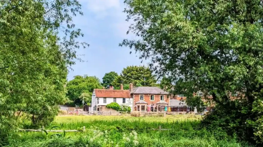
Lower Wolvercote occupies the western territory, bordering the River Thames at Godstow and the vast expanse of Port Meadow. The settlement contains older architectural specimens, including a seventeenth-century thatched cottage located on Godstow Road. This section historically accommodated the local manufacturing industry and features the remnants of the industrial paper mill. Lower Wolvercote contains three prominent public houses, including the White Hart, the Plough Inn, and Jacob’s Inn. The White Hart operates as a free house under the collective ownership of the local Wolvercote community. The proximity to the river network historically influenced the design of homes and commercial buildings, such as warehouses and workshops, in this sector. The maritime and industrial heritage remains visible in the surviving lock systems and old wharf structures, including the Wolvercote Lock and canal basins.
How did the paper mill impact the economy of Wolvercote Oxford?
The Wolvercote Oxford paper mill served as a primary industrial employer from its establishment before 1720 until its closure in 1998. The facility supplied specialized paper products to Oxford University Press and supported local families for multiple consecutive generations.
Industrial Development and University Publishing
The paper mill existed as a functioning commercial entity by 1720, when the First Duke of Marlborough purchased the property. The facility secured a vital economic role in 1782 when leased to the prominent Oxford printer William Jackson. Jackson utilized the mill to produce paper for Jackson’s Oxford Journal, a local newspaper published until 1928. The operation subsequently became the exclusive supplier of high-quality paper to the Oxford University Press publishing house. The production process relied entirely on water power until engineers installed a specialized steam engine in 1811. This technological upgrading required the consumption of 100 tons of coal every week to maintain operations. Commercial operators utilized narrowboats, including traditional wooden barges and iron hulls, to transport this coal down the Oxford Canal, utilizing the dedicated Duke’s Cut waterway link.
Twentieth Century Transformation and Modern Redevelopment
The mill underwent a complete structural rebuilding process in 1955 to modernize manufacturing capabilities and increase output. The introduction of automated machinery reduced the reliance on manual labor but maintained high manufacturing volume for decades. The enterprise ceased all paper-making operations in 1998 due to shifting global economic demands, including cheaper international imports and decreased domestic print requests. Demolition contractors leveled the entire industrial complex in 2004, leaving a large brownfield site for future use. The University of Oxford initially planned staff housing developments, including apartments and family homes, but sold the land due to rising cost projections. The developer Cala Homes purchased the site and constructed a residential neighborhood consisting of approximately 190 houses. This transition shifted the site from an industrial employment hub into a modern domestic residential zone.
What ecological features define Wolvercote Common and Port Meadow in Wolvercote Oxford?
Wolvercote Oxford contains major ecological spaces including Wolvercote Common and Port Meadow which provide ancient grazing lands beside the River Thames. These areas remain protected environments supporting local wildlife, traditional livestock farming, and diverse native plant species within modern Oxfordshire.
Ancient Common Land and Pasture Management
Wolvercote Common forms the immediate northern boundary of Port Meadow, a massive 440-acre expanse of ancient common land. Port Meadow represents an unmodified landscape that has avoided agricultural ploughing for more than 4,000 continuous years. The management of the land relies on ancient customaries, including the verification of branding and counting of heads, enforced by the Sheriff of Oxford and local commoners. The seasonal flooding of the River Thames deposits nutrient-rich silt across the soil, creating a unique alluvial ecosystem. Livestock grazing prevents the growth of coarse scrub and maintains a short, uniform grassland habitat across the plains. This specific environmental management supports three rare plant species, including creeping marshwort, apium repens, and various native sedges. The open terrain provides a critical habitat for overwintering waterfowl and migratory wading birds, including golden plovers and lapwings.
Military Activity and Twentieth Century Evacuation
The open geography of Port Meadow facilitated significant military utilization during major global conflicts, such as the First World War and the Second World War. The Royal Flying Corps established a military airfield on the meadow during the First World War period. The Royal Artillery also constructed a substantial operational base on the site to train personnel for European deployment. In June 1940, the British government established an emergency military camp on the meadow for evacuated soldiers. The camp accommodated thousands of allied troops, including British and French infantry soldiers, rescued from the beaches of Dunkirk during the Second World War. These temporary military structures, such as canvas tents and wooden barracks, were entirely removed, and the land reverted to its natural state following the war. The historical use demonstrates how the natural landscape served both ecological functions and national emergency defense needs.
Who are the notable individuals buried in Wolvercote Cemetery in Wolvercote Oxford?
Wolvercote Cemetery in Wolvercote Oxford serves as the final resting place for several globally prominent figures from literature and history. The cemetery grounds contain the official graves of author J.R.R. Tolkien and aristocrat Sir Thomas Chapman among other notable personalities.
Literary Heritage and the Tolkien Grave
Wolvercote Cemetery opened on Five Mile Drive between Banbury Road and Woodstock Road to serve the growing city population. The most frequented burial site belongs to John Ronald Reuel Tolkien, the specialized twentieth-century fantasy author and academic. Tolkien died in 1973 and shares the grave with his wife Edith, who predeceased him in 1971. The headstone features the historical names Beren and Lúthien, referencing mythological characters from his extensive legendarium writings. Fans and academic researchers, including biographers and literary students, from multiple nations, such as the United Kingdom and the United States, visit the site annually to pay tribute to the literary scholar. The presence of the grave links the geographical location of Wolvercote directly to global literary history. The local authority maintains the surrounding pathways to accommodate the regular influx of international visitors.
Historic Figures and Academic Graves
The cemetery grounds contain the remains of Sir Thomas Chapman, an Anglo-Irish baronet who lived from 1846 to 1919. Chapman is historically significant as the biological father of Thomas Edward Lawrence, known globally as Lawrence of Arabia. The cemetery also serves as the burial location for numerous University of Oxford professors, scientists, and classical scholars, including chemists and linguists. These individuals include researchers from multiple disciplines, including chemistry, linguistics, mathematics, and theological studies of the nineteenth century. The grave markers provide a historical record of the academic community that influenced British higher education. The layout of the cemetery reflects Victorian design principles, including symmetrical layouts and prominent family obelisks, with segregated plots and diverse mature tree species, such as oaks and yews, across the grounds. The site remains an active municipal cemetery managed by the Oxford City Council administrative body.
What transport infrastructure developments occurred in Wolvercote Oxford?
Transport networks transformed Wolvercote Oxford through successive structural developments including the Oxford Canal opening in 1789 and multiple rail systems. The Oxford and Rugby Railway and the Buckinghamshire Railway established critical transport connections through the village during the nineteenth century.
Canal Infrastructure and Inland Trade
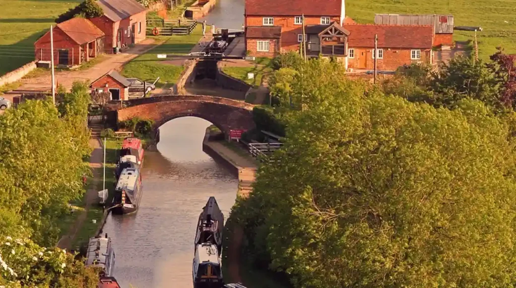
The completion of the Oxford Canal in 1789 physically bisected the village, dividing the community into two parts. The canal provided an essential transportation route for moving raw materials, including manufacturing coal and agricultural grain, between the English Midlands and southern markets. Commercial operators used narrowboats to transport essential commodities, including manufacturing coal, agricultural grain, and locally produced paper products. The canal network established a direct connection to Duke’s Cut, a short waterway linking to the River Thames. This infrastructure permitted heavy commercial traffic to bypass the difficult shallow sections of the main river network. The canal trade supported local businesses, including coal wharves, boat yards, and riverside public house establishments. The waterway remains fully operational today, serving leisure narrowboats and providing an active wildlife migration corridor.
Railway Expansion and Station Closures
Railway companies introduced rapid transit to the area with the construction of the Oxford and Rugby Railway in 1846. The tracks ran directly parallel to the existing canal, creating a dense transport corridor through the village center. The Buckinghamshire Railway followed in 1850, engineering a deep cutting and a tunnel under Upper Wolvercote. The London and North Western Railway opened Wolvercote Halt station on the strategic Varsity Line in 1905.
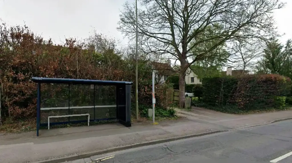
The Great Western Railway concurrently operated a separate passenger platform known as Wolvercot Platform on its northern line. Passenger demand decreased following the First World War, leading to the closure of Wolvercot Platform in 1916. The Varsity Line station, Wolvercote Halt, ceased all passenger operations in 1926 due to railway consolidations, such as the 1923 grouping and subsequent route closures, which centralized regional transit networks.
What community-led initiatives and modern developments shape Wolvercote Oxford today?
Wolvercote Oxford maintains a vibrant modern community defined by successful asset preservation and sustainable residential planning initiatives. The village successfully operates community-owned assets, localized open markets, and environmental protection programs to secure its long-term suburban autonomy within the Oxford city.
Community Asset Ownership and Social Infrastructure
Local residents established a landmark precedent by purchasing the White Hart public house to prevent commercial redevelopment. The enterprise functions as a community hub managed entirely by volunteers and elected committee members, such as trustees and treasurers. The village also hosts the Wolvercote Farmers Market, a weekly event providing locally sourced agricultural goods and artisanal products, including fresh vegetables and handmade cheeses. Educational needs remain centered at the Wolvercote Primary School, an institution tracking its origins back to the National School founded in 1817. These institutions, comprising the school and the community pub, provide critical social infrastructure that reinforces community cohesion across both territorial divisions. The financial revenue generated from community events supports local environmental conservation projects, including tree planting and pond restoration, on the adjacent common lands.
Sustainable Residential Development and Green Belt Protections
The conversion of the old paper mill site into a residential estate highlighted modern urban planning challenges, such as soil remediation and traffic infrastructure integration. Local advocacy groups, including the Wolvercote Commoners’ Committee, coordinate closely with the Oxford City Council to maintain strict green belt development restrictions. These regulations protect the peripheral natural environments, including meadows and wetlands, from intrusive commercial expansion projects. Planning frameworks mandate that new construction matches the traditional aesthetic values of the historic village architecture. Renewable energy integration and low-emission building standards, including solar panel arrays and triple glazing, guide current residential upgrades within the ward. The community balances the need for expanding housing options with the preservation of historical landscapes and ecological habitats, including bird nesting zones and ancient grazing fields.
FAQs About Wolvercote Oxford
Is J.R.R. Tolkien actually buried in Wolvercote Cemetery, and can you visit the grave?
Yes, the famous author of The Lord of the Rings is buried alongside his wife, Edith, in Wolvercote Cemetery on Five Mile Drive. The grave is fully accessible to the public and features the legendary names Beren and Lúthien carved into the headstone. Literary enthusiasts and researchers from all over the world visit the site annually, and the local authority maintains pathways to safely accommodate this regular influx of visitors.
What makes Port Meadow and Wolvercote Common ecologically unique?
Port Meadow and Wolvercote Common form a massive 440-acre expanse of ancient common land that has avoided agricultural ploughing for over 4,000 continuous years. The seasonal flooding of the nearby River Thames deposits rich silt across the soil, creating a highly specific alluvial ecosystem. This unique environment supports exceptionally rare plant species, such as creeping marshwort, while providing a critical habitat for migratory wading birds.
What is the main difference between Upper Wolvercote and Lower Wolvercote?
The two distinct territorial divisions are physically bisected by the historic Oxford Canal infrastructure, which gives each side a unique architectural layout. Upper Wolvercote lies to the east near Woodstock Road, serving primarily as a residential zone featuring Saint Peter’s Church and the local primary school. Lower Wolvercote extends to the west toward the River Thames, containing older seventeenth-century thatched cottages, traditional community pubs, and industrial heritage sites.
What stands on the site of the historic Wolvercote Paper Mill today?
The historic paper mill, which served as a major industrial employer and a primary paper supplier for Oxford University Press, ceased all operations in 1998. Following the complete demolition of the industrial complex in 2004, the prominent brownfield site underwent extensive environmental planning and soil remediation. The land was ultimately purchased by developer Cala Homes, who transformed the former industrial hub into a modern residential neighborhood featuring roughly 190 homes.
Why do people on Reddit and Quora highly recommend Wolvercote as a place to live?
Wolvercote is frequently recommended because it seamlessly combines a peaceful, historic countryside atmosphere with direct transport links to the bustling Oxford city centre. Users praise the vibrant local community spirit, which is anchored by unique assets like the collectively owned White Hart public house and a weekly farmers market. Furthermore, the strict green belt protections guarantee that residents retain immediate access to unspoiled natural landscapes like Port Meadow.