Oxford’s city walls and gates stand as silent witnesses to centuries of strategic defense, royal intrigue, and urban evolution. Built primarily in the 13th century, these fortifications transformed a Saxon settlement into a formidable medieval stronghold, protecting scholars, merchants, and kings alike.
Origins in Saxon Times
The story of Oxford’s city walls begins long before the stone ramparts we admire today, rooted in the late 9th century when the town emerged as a burh—a fortified refuge against Viking raids. In 911 AD, Oxford was designated one of Alfred the Great’s defensive burhs, encircling a modest area with earthen banks and ditches that leveraged the natural barriers of the River Thames and Cherwell. These early earthworks, mentioned in the Domesday Book of 1086, underscored Oxford’s growing importance as a frontier outpost between Wessex and Danish-held Mercia.
Following the Norman Conquest in 1066, the defenses saw initial reinforcements, likely including wooden palisades atop the Saxon banks. Robert D’Oyly’s construction of Oxford Castle in 1071 further integrated the town into a broader network of Norman strongholds, with the castle’s mound providing oversight of the western approaches. By the early 12th century, King Henry I’s 1121 charter granted Oxford municipal privileges, spurring prosperity that necessitated stronger protections amid feudal unrest. Yet, it was the anarchy of King Stephen’s reign in the 1140s that exposed vulnerabilities—a massive fire in 1138 razed much of the town, and Queen Matilda’s dramatic escape from a besieged Oxford Castle in 1142 highlighted the limitations of makeshift barriers.
Construction of the Medieval Walls
The pivotal phase arrived in the 13th century, when Oxford’s leaders undertook a grand project to replace the aging Saxon defenses with a stone curtain wall. Construction commenced around 1226-1240, enclosing approximately 120-130 acres in a roughly rectangular circuit spanning about two miles. Funded through tolls, royal grants, and civic levies, the walls rose from local limestone, featuring crenellated battlements, over 25 semi-circular bastions for enfilading fire, and a wide ditch expanded to 200 feet in places—though this extension was briefly revoked amid the 1381 Peasants’ Revolt tensions.
Architecturally, the walls averaged 15-20 feet high, with towers reinforcing key sectors. The design reflected contemporary military science, allowing defenders to cover approaches from multiple angles while accommodating the town’s expansion beyond Saxon limits. Running north along George Street, Broad Street, and Holywell Street; east by New College and the Botanic Garden; south past Christ Church and Merton College; and west via Castle Street, the perimeter created a secure core for Oxford’s burgeoning university and trade. This era’s walls were not merely defensive; they symbolized civic pride, regulating commerce through controlled access points and fostering the intellectual haven that defines Oxford.
Historical records, including municipal accounts from the period, detail phases of work: initial eastern and southern stretches by 1230, with northern and western completions amid funding disputes. Bastions, often open-backed for economic efficiency, dotted the circuit, their strategic placement evident in surviving fragments like those in New College gardens—the best-preserved section today.
The Iconic City Gates

At the walls’ heart were the gates, grand portals that served as both gateways and chokepoints. Four principal gates aligned to the cardinal directions, their toll roads converging at Carfax—the medieval market hub—while minor posterns handled secondary traffic. These structures blended functionality with symbolism, often flanked by towers and portcullises.
East Gate, piercing the wall near the Botanic Garden, was the first major build around 1230, controlling access from London via the Iffley Road. A robust double-towered edifice, it featured a chapel above for weary travelers, demolished only in 1771 amid Georgian expansion. North Gate, at the end of St Aldate’s, guarded routes to Banbury; its demolition in 1670 cleared space for traffic, though chronicles describe it as modestly fortified.
South Gate, near Christ Church, oversaw Thames crossings, while West Gate—longest surviving until its 1600 removal—stood sentinel against castle approaches, backed by a postern and artillery platform as noted by 17th-century antiquarian Anthony Wood. Lesser gates included Bocardo (north, near Gloucester Green, razed 1772), a prison-like twin-towered structure; Fish Street Gate (south); and posterns like Turl Street’s twirling gate, felled in 1722. Each gate regulated trade—tolls on wool, grain, and scholars’ goods filled coffers—while enabling spectacles, from royal processions to market days.
Role in Wars and Sieges
Oxford’s walls proved their mettle in conflict, evolving from passive barriers to active battlegrounds. During the First Barons’ War (1215-1217), royalists held the town against rebels, leveraging bastions for archery. The most dramatic test came in the English Civil War (1642-1646), when Charles I decamped to Oxford as his capital, deeming the walls inadequate.
In 1642, urgent repairs ensued: citizens aged 16-60 labored weekly or paid fines, erecting earthwork forts beyond the stone circuit, blockading rivers, and manning bastions. A 1644 map reveals concentric defenses north of St Giles’, with guards at gates and sconces along the Thames. Parliamentary forces besieged the city in 1646, but disease and starvation forced surrender before walls crumbled—Parliament ordered slighting to prevent reuse, though core remnants endured. Earlier, the 1013 Danish sack and Canute’s 1018 coronation underscored pre-medieval roles, while 12th-century fires tested resolve.
These events cemented Oxford’s walls in lore: sites of Matilda’s 1142 escape via castle ropes and Civil War trenches where cavaliers clashed with roundheads.
Decline and Demolition
By the 17th century, gunpowder rendered stone walls obsolete, accelerating decay. Gates fell first: West Gate in 1600 for street widening, East Gate in 1771, Bocardo in 1772, mirroring national trends toward open cities. Georgian and Victorian growth demanded space—canals (1790), railways, and colleges encroached, with walls quarried for buildings or buried under roads.
Municipal neglect compounded natural erosion; by 1800, only fragments persisted amid slums and gardens. 19th-century antiquarians like Wood preserved records, but systematic demolition peaked post-1646, leaving less than 10% intact. Legal protections emerged late: the 1900s saw scheduling as ancient monuments, halting further loss.
Surviving Remnants Today
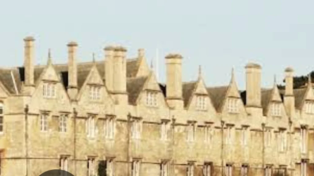
Modern Oxford treasures its walls’ echoes, with prime sections in New College’s southeast gardens—bastioned curves from 1226-40, among England’s finest medieval survivals. Other highlights include Christ Church’s southern flank, Merton College bounds, and castle-adjacent western stretches. The Botanic Garden path reveals eastern bastions, while Broad Street’s subsurface traces intrigue archaeologists.
These remnants, often ivy-clad and plaque-marked, invite exploration via walking trails like the “Walls Walk.” They frame university quads, reminding visitors of defenses that shielded luminaries from Newton to Tolkien. Preservation by Historic England ensures longevity, with occasional digs uncovering artifacts like arrowheads.
Architectural and Cultural Legacy
Beyond stone, Oxford’s walls shaped identity. Their bastioned design influenced later forts, blending Roman echoes with French models via university cosmopolitans. Culturally, they starred in literature—Anthony Wood’s histories romanticize gates, while Lewis Carroll evoked bastions in Alice’s adventures.
Today, they boost heritage tourism, underpinning Oxford’s UNESCO-bid-worthy center. Echoes in place names (Bocardo Street) and festivals perpetuate memory, linking medieval might to a city of spires. As climate and urban pressures mount, these walls symbolize resilience—enduring sentinels in a changing world.
Enduring Significance for Oxford
Oxford’s city walls and gates encapsulate a narrative of adaptation: from Viking bulwarks to Civil War ramparts, their story mirrors England’s turbulent path. Preserved amid 21st-century bustle, they offer timeless lessons in fortification ingenuity and civic fortitude. For locals and visitors, tracing their path reveals not just history, but the foundations of one of the world’s great cities—walls that once held back armies now embrace knowledge.
What tower in Oxford has 99 stairs?
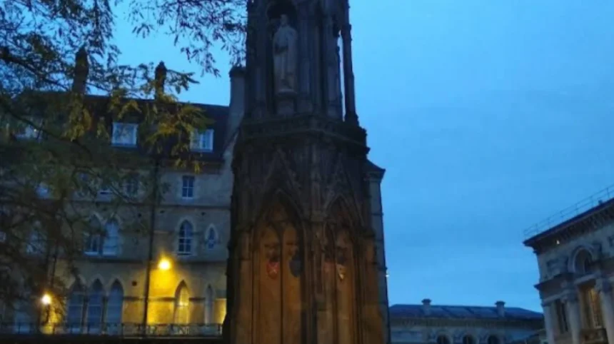
Carfax Tower, the sole surviving remnant of St Martin’s Church at Oxford’s historic crossroads, features a steep climb of 99 narrow steps to its summit. This ascent rewards visitors with panoramic views over the city’s spires and dreaming towers, tying into the medieval layout once framed by the city walls.
Why is it called Dead Man’s Walk in Oxford?
Dead Man’s Walk is a historic footpath south of Merton College, just outside the old city walls, named for its use as a route for medieval Jewish funeral processions from the Jewish quarter to their cemetery near the Botanic Garden around 1190-1231. It evokes the somber history of Oxford’s Jewish community before their expulsion in 1290, with a memorial slab in the garden preserving the tale.
What was Hitler’s plan for Oxford?
During World War II planning for Operation Sea Lion, Hitler spared Oxford from bombing, intending it as the capital of a conquered Britain rather than a target for destruction. Bodleian Library documents reveal German research on local geography and infrastructure to support this vision of Oxford as the seat of a new Nazi provincial kingdom.
Who is the most famous person from Oxford?
Oscar Wilde stands out as one of Oxford’s most iconic figures, the Irish playwright and poet who studied at Magdalen College and penned masterpieces like The Importance of Being Earnest.
What did Imran Khan study at Oxford?
Imran Khan, former Pakistan Prime Minister and cricketing legend, studied Philosophy, Politics, and Economics (PPE) at Keble College, Oxford, graduating in 1975.