Key Points
- Oxfordshire County Council unveiled plans for the Oxford Greenways network, which comprises 18 car-free active travel routes.
- The network will connect surrounding towns and villages to Oxford city center through traffic-free paths, upgraded cycle tracks, and resurfaced routes.
- Council plans outline goals to increase active travel, reduce traffic congestion, improve public health, and create safer routes for cyclists, wheelers, and pedestrians.
- Designated corridors link communities including Abingdon, Witney, Kidlington, Wheatley, and Eynsham to employment and educational sites across Oxford.
- Funding and delivery plans align with the county council’s active travel infrastructure goals and climate targets.
OXFORDSHIRE (Oxford Daily) October 2, 2026 — Plans to transform travel across Oxfordshire have been formally unveiled, introducing a network of 18 car-free active travel corridors designed to link surrounding towns and rural communities directly with Oxford. The long-term infrastructure initiative, known as Oxford Greenways, proposes an extensive web of dedicated walking, wheeling, and cycling paths intended to provide safe, fully segregated alternatives to commuting by private motor vehicle.
- Key Points
- What Is the Oxford Greenways Project?
- Which Towns and Villages Will Be Connected to Oxford?
- How Will the Routes Achieve a Car-Free Experience?
- Why Is Oxfordshire County Council Prioritising Active Travel Infrastructure?
- Background of the Oxford Greenways Development
- Prediction: How Will This Development Impact Oxfordshire Residents and Business Owners?
What Is the Oxford Greenways Project?
As reported by transport reporters at the Oxford Mail, the Oxford Greenways project represents a fundamental shift in regional transport policy, aiming to connect outlying residential areas with the county’s economic and educational heart. The scheme comprises 18 distinct routes that will either upgrade existing paths or construct brand-new, traffic-free corridors.
The primary objective of the network is to give residents viable non-motorised transit choices for daily journeys, reducing reliance on busy arterial roads into Oxford. By focusing on high-quality surfacing, clear signposting, and complete separation from motorized traffic, local transport planners aim to make active travel accessible to users of all ages and physical abilities.
Which Towns and Villages Will Be Connected to Oxford?
According to details published by The Oxford Times, the 18 Greenways span all major corridors feeding into the city. Key routes include direct connections from market towns such as Abingdon, Witney, Kidlington, Eynsham, and Wheatley, as well as smaller rural villages that currently lack safe pedestrian or cycle access to Oxford.
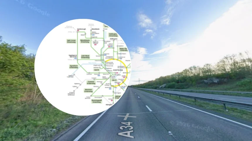
The proposed routes aim to link commuters directly with major employment hubs, including the Oxford Science Park, Headington’s hospital and university campuses, and the city center main railway station. Maps released alongside the proposal detail how individual paths will interface with existing local infrastructure and public transport interchanges.
How Will the Routes Achieve a Car-Free Experience?
As outlined by transport writer Dominic Penna in local coverage of the council’s active travel initiatives, the common design standard across all 18 routes is the exclusion of general motor traffic. Where paths run alongside existing roadways, physical barriers or wide grass verges will be utilized to maintain total separation between cyclists, wheelers, and motor vehicles.
In countryside sectors, former rail corridors, canal towpaths, and bridleways are being incorporated into the scheme. Resurfacing work using weather-resistant, smooth materials will ensure the Greenways remain usable year-round, eliminating the seasonal mud and flooding issues that historically deterred winter commuters.
Why Is Oxfordshire County Council Prioritising Active Travel Infrastructure?
As noted by climate and transport correspondents at the Oxford Clarion, Oxfordshire County Council has framed the Greenways project as a critical element of its Local Transport and Connectivity Plan. The council aims to significantly reduce carbon emissions from transport while simultaneously tackling the severe traffic congestion that regularly paralyzes the city’s ring road and historic center.
Local health authorities have also voiced support for the infrastructure, citing research that indicates safe active travel networks directly correlate with increased physical exercise, reduced air pollution, and improved mental well-being among suburban and rural populations.
Background of the Oxford Greenways Development
The introduction of the 18 car-free Greenways represents the culmination of several years of active travel planning and public consultation across Oxfordshire. Historically, while Oxford city itself maintains high cycling participation rates compared to the national average, cross-county commuting from outer towns has remained overwhelmingly reliant on private cars due to fragmented, unsafe peripheral roads.
Previous attempts to encourage non-car travel relied heavily on painted cycle lanes on busy roadways, which many residents viewed as inadequate for safety. Following the adoption of updated national active travel standards (LTN 1/20), local transport officers shifted focus toward fully segregated networks.
The Oxford Greenways strategy was formulated to act as the primary connective framework binding Oxfordshire’s rural districts to the city’s broader transport ecosystem.
Prediction: How Will This Development Impact Oxfordshire Residents and Business Owners?
If fully constructed and maintained to high safety standards, the 18 car-free Greenways will fundamentally reshape commuting patterns for tens of thousands of residents across Oxfordshire.
For suburban and rural commuters, the network offers an immediate, cost-effective alternative to rising fuel costs, parking charges, and congestion delays. Commuters from towns like Abingdon and Eynsham will gain reliable, predictable journey times into Oxford during peak hours, fostering better health outcomes and substantial financial savings.
For local businesses and central retailers, improved non-motorised access could boost footfall by making the city center more accessible to visitors who prefer not to navigate urban driving restrictions.
Conversely, transport planners must manage potential friction during construction phases to ensure minimal disruption to current road users and farmland owners along designated pathway alignments. In the long term, the Greenways are expected to serve as a model for regional active travel integration across the South East.